v0.1.8 — Two-stage calibration + dark basemap

Weather Routing & Performance Analytics

Physics-based fuel consumption modelling, multi-source weather data, and route optimization algorithms for merchant ships.

Tools belong on board

Route analysis and performance monitoring belong where decisions are made. The Master and bridge team should have direct access to the models, the data, and the reasoning behind every recommendation.

Transparent Models

Every calculation can be inspected, every assumption challenged, and every parameter calibrated against real operational data. No black boxes.

Core Open Source

The core routing engine, physics models, and weather integration are open source under Apache 2.0. Every calculation can be audited and every parameter calibrated against real operational data.

Proprietary Data

Your vessel's data stays yours. The performance model lives on board or on your own server — no vendor lock-in, no data leakage, and the operators who navigate the vessel own and understand the tools they rely on.

Features

End-to-end voyage intelligence

From hydrodynamic resistance calculations and engine SFOC curves to real-time weather overlays and IMO CII compliance — all in one platform.
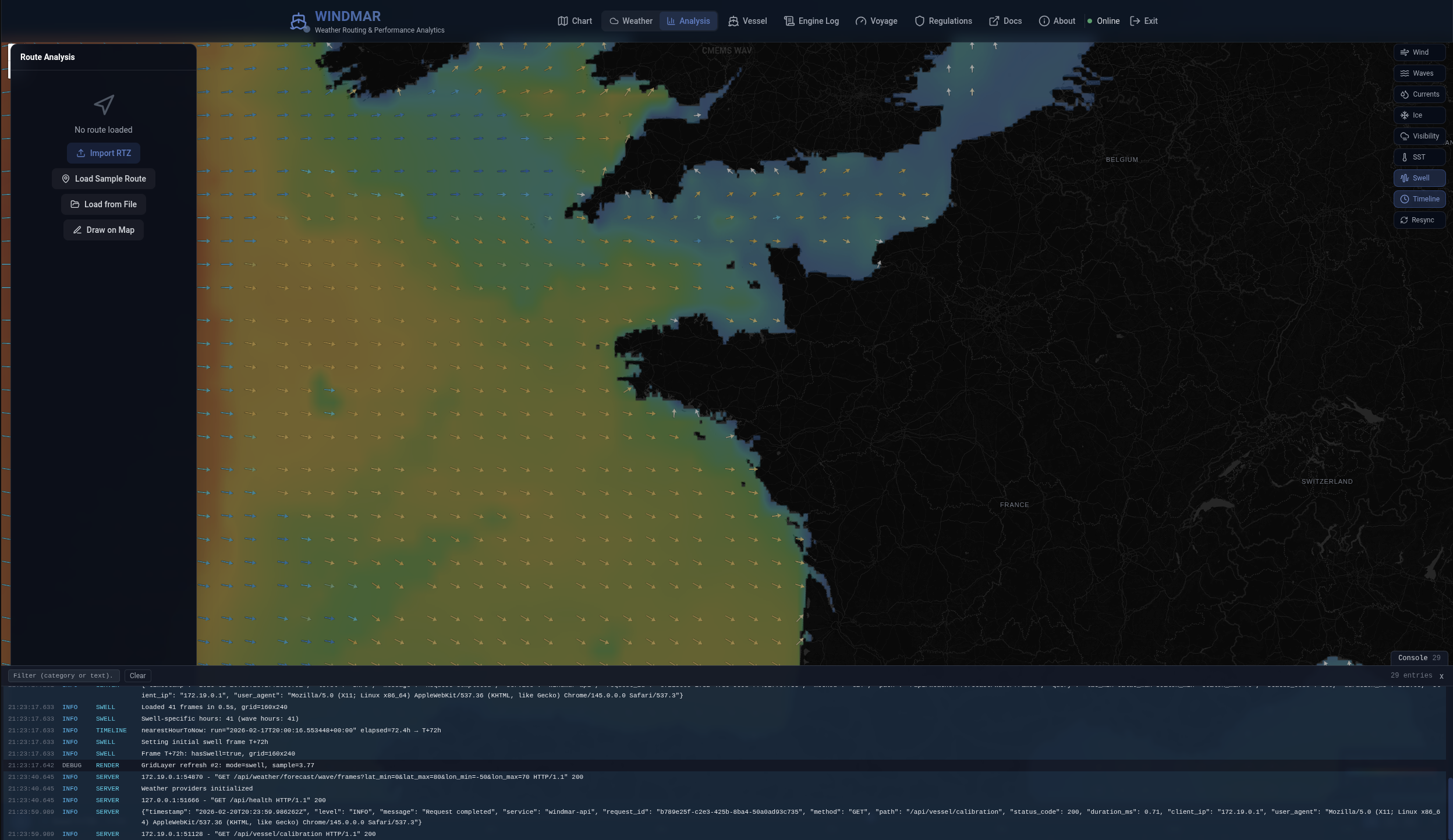
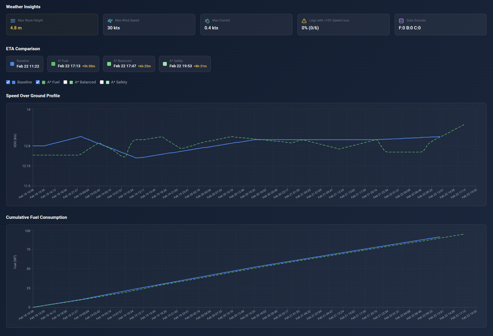
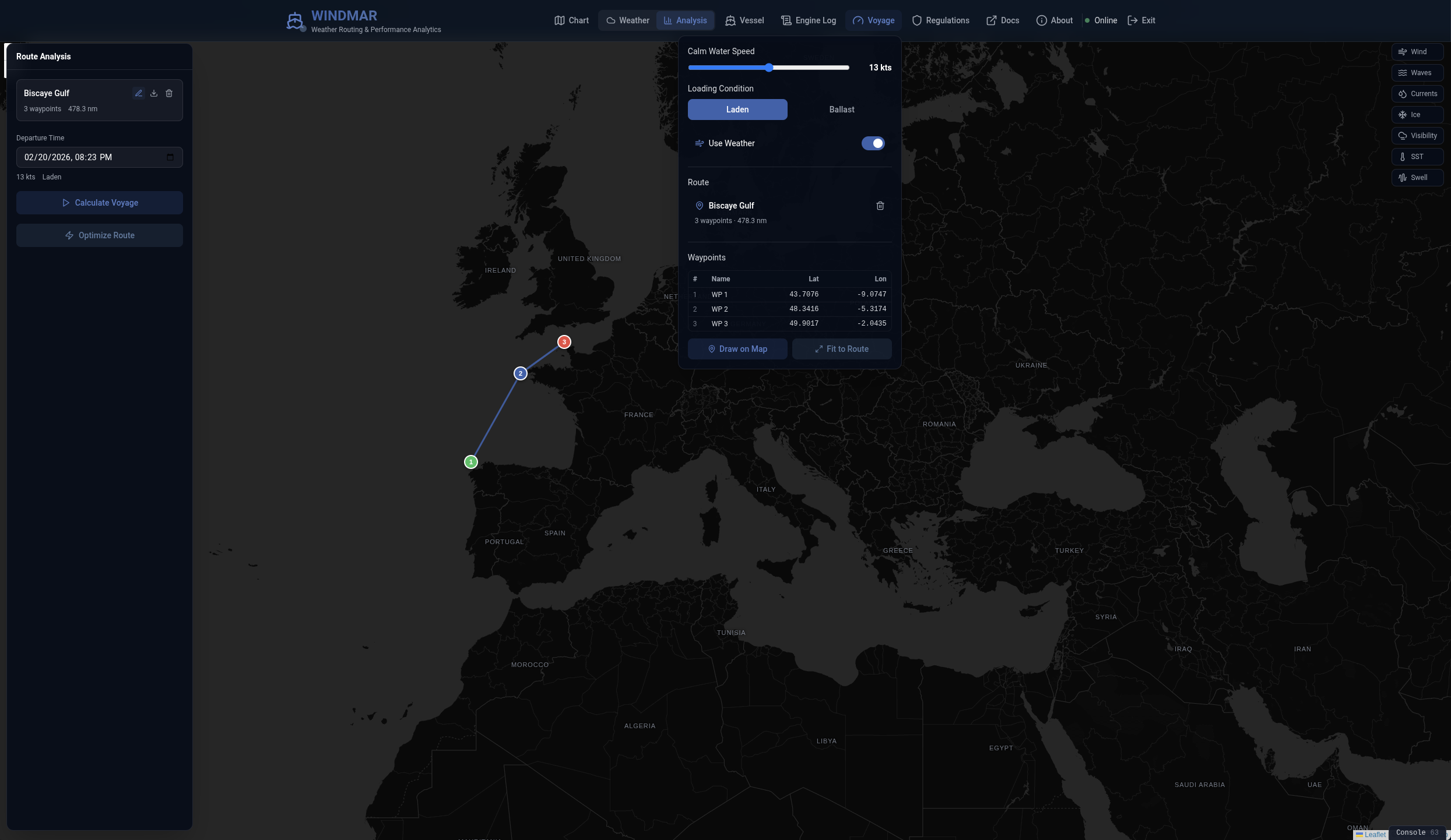
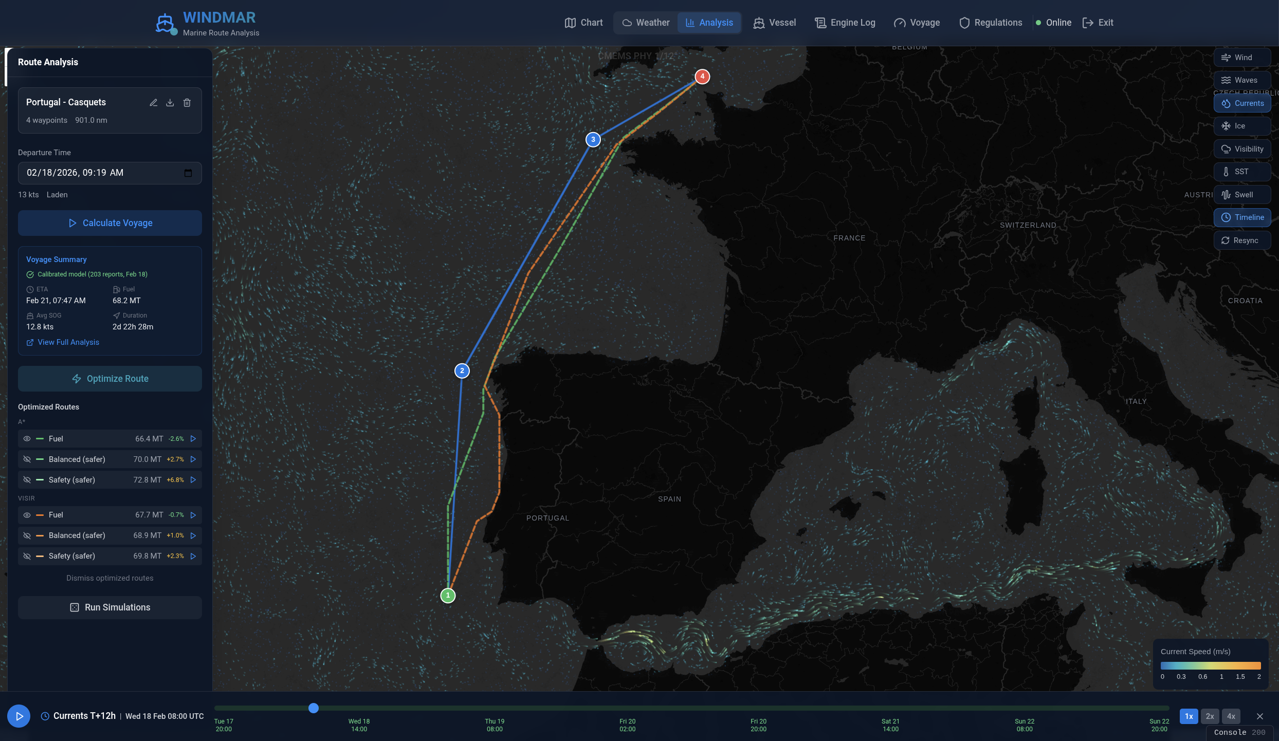
Route Optimization

A* grid search with 9 pre-validated commercial strait shortcuts, GSHHS sub-km coastline polygons, course-change penalty, safety fallback routing, and multi-objective Pareto front for fuel vs. time trade-offs. VISIR Dijkstra available as optional secondary engine. Monte Carlo P10/P50/P90 envelopes quantify uncertainty.

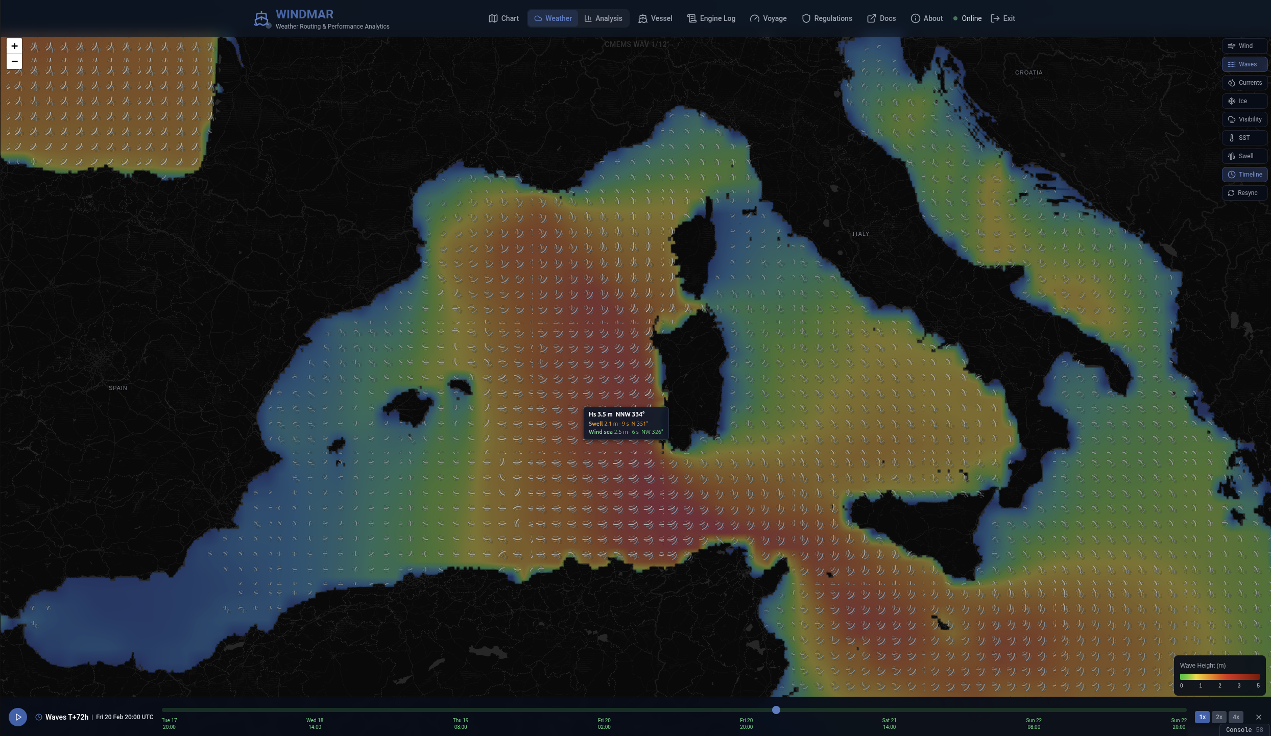
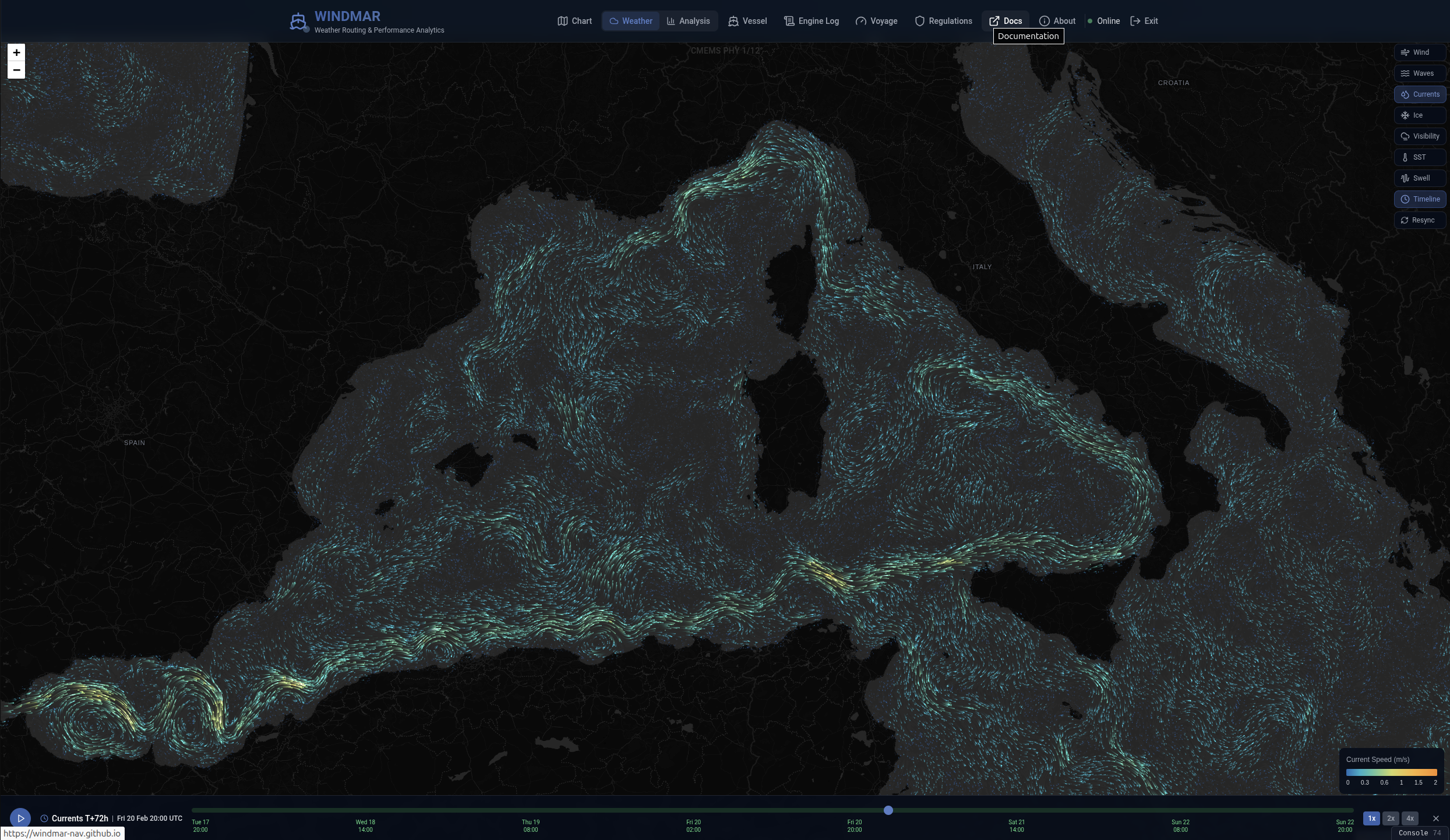
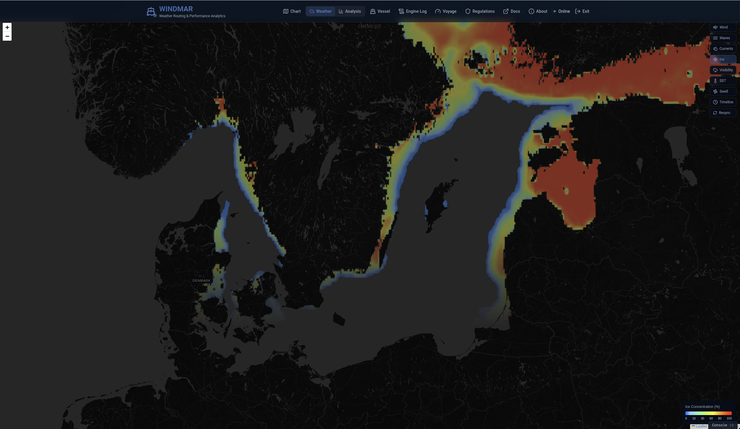
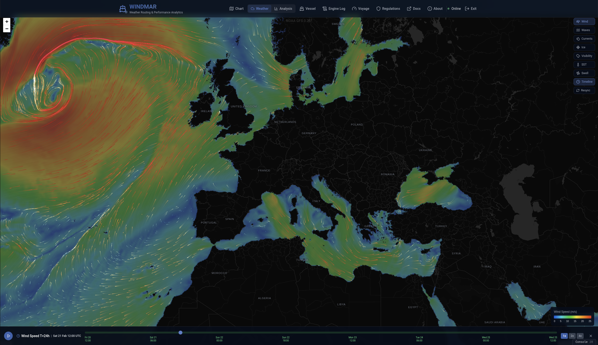
7-Layer Weather Overlays

Wind (GFS 0.25°), waves, currents, SST, swell, visibility, and ice from Copernicus Marine and NOAA. WMO-standard color ramps, forecast timeline (f000–f120), and animated particle flow. Pre-ingested into PostgreSQL for sub-second queries.

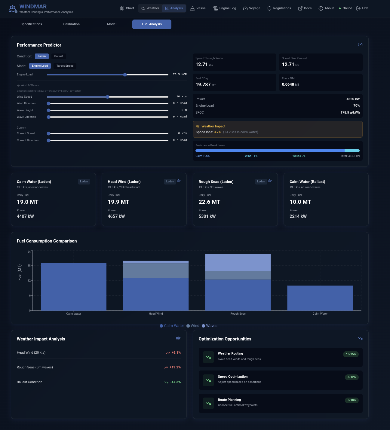
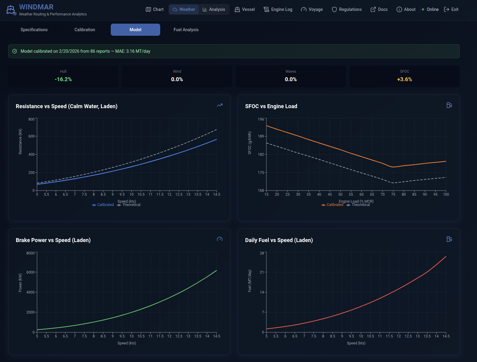
Vessel Performance Model

Holtrop-Mennen hull resistance, Blendermann wind loads, Kwon/STAWAVE-1 wave resistance, and quadratic SFOC curves. Calibrate against engine log data to match real-world performance. Four model curves — resistance, power, SFOC, daily fuel — with theoretical vs. calibrated comparison.

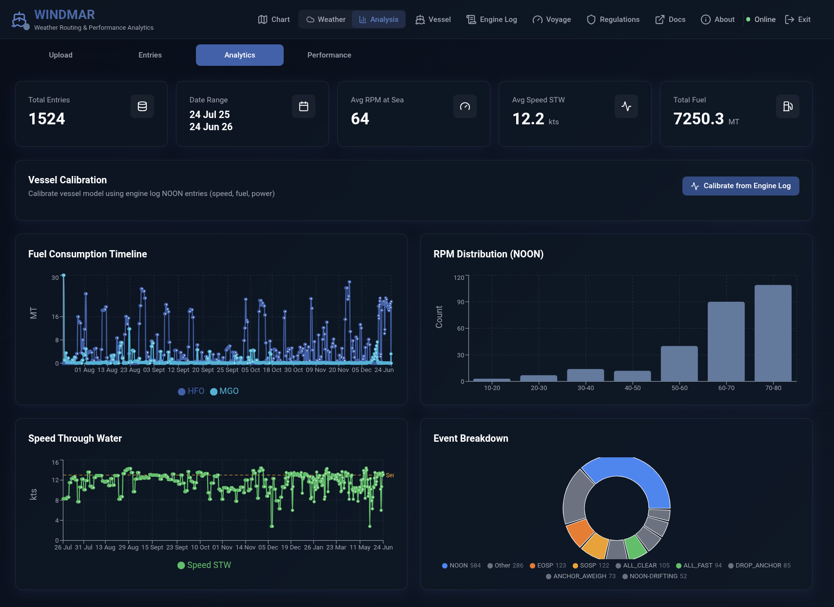
Engine Log Analytics

Upload CSV or Excel noon reports. Five KPIs, six interactive charts — fuel consumption timeline, RPM distribution, speed through water, event breakdown. One-click calibration bridge connects log data to the physics model.
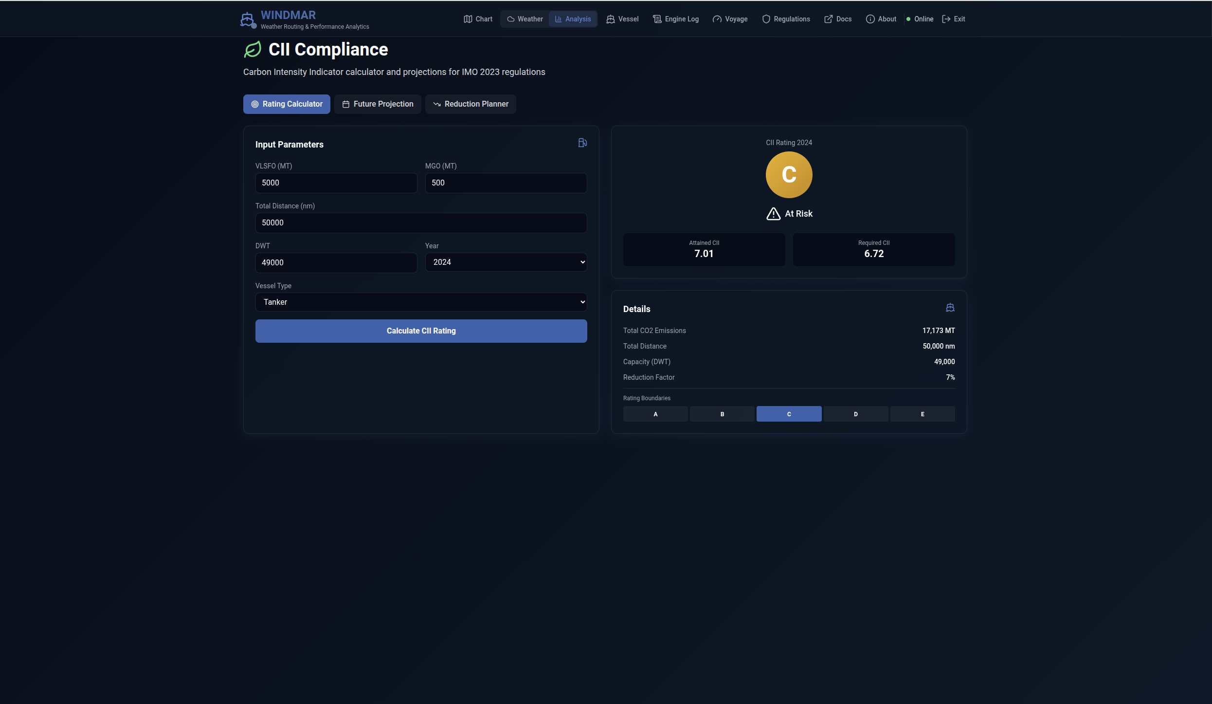
IMO CII Compliance

Calculate Carbon Intensity Indicator ratings for any voyage. Future projections, reduction planner, and rating boundaries (A–E) per IMO MEPC guidelines. Assess regulatory compliance before departure.

Built for real operations

Multi-Source Weather

NOAA GFS + Copernicus CMEMS. 7 layers, user-triggered resync, viewport-aware downloads, climatology fallback.

Production Optimizer

A* with GSHHS coastline, 9 strait shortcuts, course-change penalty, safety fallback, Pareto front, and 0.5 kt speed steps.

Physics Engine

Holtrop-Mennen, Blendermann, Kwon, STAWAVE-1. Seakeeping motions, slamming, parametric roll criteria.

Engine Log Calibration

Upload noon reports, calibrate hull/wind/wave/SFOC factors. Match model to real-world performance data.

Monte Carlo Simulation

Correlated weather perturbations. P10/P50/P90 fuel and ETA envelopes for risk-aware voyage planning.

Regulatory Zones

20 TSS polygons, 6 ECA boundaries, High Risk Area, Suez/Panama canal zones. Cost penalties in optimizer.

CII & FuelEU Maritime

IMO CII calculator with A–E ratings. FuelEU GHG intensity, compliance balance, pooling scenarios, penalty estimator.

SOG Profile & ETA

Time-based speed over ground charts, cumulative fuel curves, ETA comparison bars for all route variants.

Self-Hosted

Docker Compose deployment. PostgreSQL + Redis + FastAPI + Next.js. No cloud dependency. Runs on a laptop.

Gallery

See it in action

Click any screenshot to view full resolution.

Weather layers & WMO wind barbs (v0.1.5 — pre-dark-basemap)

What this release does not do

WindMar is an active open-source project. The current release has the following constraints.

Constraint Detail
Forecast horizon 5 days (GFS f000–f120). No historical reanalysis.
Wind source NOAA GFS (0.25°). Free, no credentials needed.
Wave / current source CMEMS. Requires a free Copernicus Marine account.
ERA5 Not active in this release. CDS credentials accepted but ingestion is disabled.
Coverage North Atlantic / NW Europe (ADRS 1+2). Configurable via area selection.
Data refresh Manual — user triggers resync per layer. No background scheduler.
Vessel type Calibrated for MR product tankers. Other vessel types require parameter adjustment.

For voyages beyond the 5-day forecast window, the system uses climatological fallback values (monthly averages).

Try It Locally

Run it on your machine in 2 minutes

Pre-loaded weather data, engine logs, and noon reports. No API keys required for wind data.

mkdir windmar && cd windmar
curl -LO https://raw.githubusercontent.com/windmar-nav/windmar-demo/main/docker-compose.standalone.yml
curl -L -o .env https://raw.githubusercontent.com/windmar-nav/windmar-demo/main/.env.standalone
docker compose -f docker-compose.standalone.yml up -d

Then open http://localhost:3000

Full Instructions Contact

Support Open-Source Weather Routing

WindMar is free and open source. Sponsorships help fund development of ERA5 reanalysis, global coverage, automated weather refresh, and new vessel types.

Sponsor on GitHub